
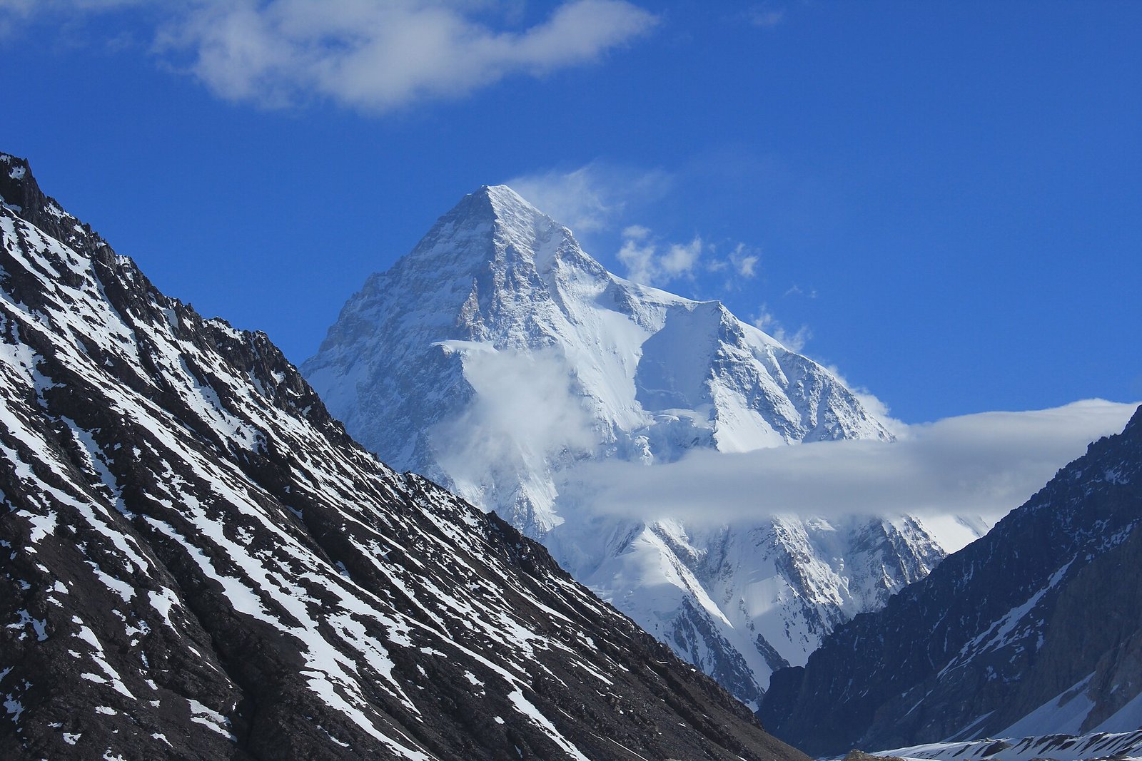
K2 is the second-highest mountain on Earth — and by almost every measure that matters to the people who climb it, the hardest. Everest is taller, but K2 is steeper, wilder, further from help and far less forgiving of mistakes. It stood unclimbed in winter until 2021, decades after Everest’s first winter ascent, and for most of its history it killed roughly one in every four climbers who reached its summit.
Here is the part most articles bury at the bottom: you do not need to be a mountaineer to stand in front of K2. Every summer, fit trekkers walk up the Baltoro Glacier to Concordia and K2 Base Camp, sleep beneath the mountain and walk out again — no ropes, no oxygen, no summit bid. This guide covers the mountain itself first: where K2 is, how high it is, why it is so dangerous, and the story of the people who have climbed it. Then it explains how ordinary travellers can see it with their own eyes.
K2 quick facts
- Height: 8,611 m (28,251 ft) — the second-highest mountain on Earth, after Everest (8,849 m)
- Range: Karakoram, in Gilgit-Baltistan
- Location: On the border between Pakistan and China; the standard approach, base camp and climbing route are on the Pakistan side
- Local name: Chogori — Balti for “Big Mountain” (K2 is also nicknamed “the King of Mountains”)
- Other names: Mount Godwin-Austen; nicknamed “the Savage Mountain”
- First climbed: 31 July 1954, by an Italian expedition
- First winter ascent: 16 January 2021 — the last of the fourteen 8,000 m peaks to be climbed in winter
- Nearest town: Skardu, the gateway for treks and expeditions
- Best months to see it: Mid-June to mid-September (the Baltoro trekking season)
Where Is K2?
K2 rises in the Karakoram range in Gilgit-Baltistan, in the far north of Pakistan, right on the border with China’s Xinjiang region. It is not part of the Himalaya — the Karakoram is a separate, wilder range, and it holds the greatest concentration of high peaks on Earth: four of the world’s fourteen 8,000 m mountains (K2, Broad Peak, Gasherbrum I and Gasherbrum II) stand within sight of each other here.
The mountain’s official name is a surveyor’s label. In 1856, officers of the Great Trigonometrical Survey of India catalogued the Karakoram peaks from a distance and marked this one “K2” — the second peak of the Karakoram. A later name, Mount Godwin-Austen, honoured a British surveyor who explored the region, but it never really stuck. Locally, the mountain is known as Chogori.
Geography decides how you visit. The Chinese side of K2 is extremely remote and rarely used by foreign travellers. Almost everything you have ever read about K2 — the base camp, the classic climbing route, the famous photographs — is on the Pakistan side, reached from the town of Skardu in Baltistan. From Skardu, jeeps climb to the village of Askole, the last settlement before the wilderness, and from there the only way in is on foot, up the Baltoro Glacier.
How High Is K2 — and Why Is It Harder Than Everest?
K2 stands 8,611 m (28,251 ft) above sea level. That makes it 238 m lower than Everest (8,849 m) — close enough that for years some people argued over which was really taller — but height is almost the only contest Everest wins.
It is steeper. Everest has a route that strong, well-supported climbers can largely walk up. K2 has no such route. Even the standard line, the Abruzzi Spur, involves steep rock steps, exposed ridges and long sections on 50-degree ice and snow, including the near-vertical ice wall of the Bottleneck at about 8,200 m, climbed in the shadow of hanging seracs.
The weather is worse. K2 sits further north than Everest and directly in the path of storms rolling off the Karakoram. Winds are stronger, temperatures lower, and clear summit windows shorter and harder to predict. Climbers regularly wait weeks at base camp for a few usable days.
It is far more remote. If something goes wrong high on Everest, there are other teams, fixed lines and helicopters below you. On K2, the nearest town is days away on foot and by jeep, weather often grounds rescue helicopters, and for most of the mountain’s history there was simply nobody else up there. Help, in any meaningful sense, does not exist.
The record shows it. K2 was not climbed in winter until January 2021 — Everest managed it in 1980. And as the next sections show, the mountain’s fatality record is in a different league from Everest’s, even though Everest sees far more climbers.
A Short History of Climbing K2
People have been trying to climb K2 for well over a century, and the mountain resisted for fifty years. An early attempt in 1902 reached the lower slopes. In 1909 the Duke of Abruzzi surveyed the mountain and identified the south-east ridge — still called the Abruzzi Spur — that remains the standard route today. American teams came close in 1938 and 1939, and the 1953 American expedition became famous for its desperate retreat in a storm, during which Pete Schoening’s ice-axe belay saved five falling climbers at once. It was a member of that era’s expeditions, George Bell, who gave K2 its enduring nickname, calling it “a savage mountain that tries to kill you.”
The summit finally fell on 31 July 1954, when Achille Compagnoni and Lino Lacedelli of Ardito Desio’s large Italian expedition reached the top — a landmark moment in Italian mountaineering that is still celebrated today.
The last great prize took another 67 years. Winter attempts on K2 failed for decades, defeated by hurricane winds and temperatures below −50 °C. Then, on 16 January 2021, a team of ten Nepali climbers — among them Nirmal Purja and Mingma Gyalje Sherpa — linked arms and walked the final metres to the summit together, singing Nepal’s national anthem. K2 became the last of the fourteen 8,000 m peaks to be climbed in winter, and for many people that shared, deliberate style of ascent is as memorable as the achievement itself.
How Dangerous Is K2?
Honestly: very. For most of the twentieth century, roughly one climber died for every four who reached the summit — a fatality ratio several times higher than Everest’s. The deadliest single episode came in August 2008, when collapsing seracs above the Bottleneck killed eleven climbers in one weekend.
The picture has improved in recent seasons. Fixed ropes, larger support teams, better weather forecasting and more climbers attempting the mountain in good conditions have brought the recent death rate down, and some recent summers have seen large numbers of summits with few or no fatalities. But the underlying hazards have not changed: the Bottleneck’s seracs, rockfall, avalanches, storms that arrive with little warning, and altitude — at 8,611 m, every climber is deep in the “death zone”, where the body steadily deteriorates and a simple mistake becomes fatal.
The fairest summary is this: Everest is a very serious undertaking that thousands of guided clients now complete each year. K2 remains a mountain for experienced high-altitude mountaineers only, where even doing everything right cannot remove the risk. That reputation is exactly why seeing it from below — safely, on foot — is such a powerful experience.
Can You See K2 Without Climbing It?
Yes — and this is how almost everyone who has ever stood in front of K2 actually did it. You trek. The Baltoro Glacier, one of the longest glaciers outside the polar regions, runs for some 63 km straight into the heart of the Karakoram, and the trail up it ends at one of the great mountain viewpoints on Earth.
The journey goes like this. You fly from Islamabad to Skardu (about an hour, weather permitting) or drive the Karakoram Highway, then take jeeps to Askole. From there you walk for about a week as the valley narrows, the glacier widens and the peaks grow — the Trango Towers, then the Gasherbrums — until K2 itself slides into view ahead of you. The climax is Concordia, at about 4,600 m, where the Baltoro meets the Godwin-Austen Glacier. From your tent there you look straight up the final stretch of glacier to K2, with Broad Peak and Gasherbrum IV around you: four of the world’s fourteen 8,000 m peaks in a single panorama. Most trekkers push on for a night at K2 Base Camp itself, at about 5,050 m, and watch the climbers’ headtorches on the Abruzzi Spur.
The trekking season runs from mid-June to mid-September, with July and August offering the steadiest weather. You need to be genuinely fit — this is two weeks of walking on glacier moraine at altitude — but it is a trek, not a climb: no technical skills, no ropes, and porters carry the camp. For most people who do it, standing at Concordia rates alongside anything they have done in the mountains anywhere. It is no accident that the route is consistently ranked among the best treks in Pakistan — and we would argue, the world.
The K2 Base Camp Trek in Brief
The classic itinerary takes about 22 days from Islamabad: flights or road to Skardu, jeeps to Askole, then the slow walk up the Baltoro through Paiju, Urdukas and Goro to Concordia and K2 Base Camp, with rest days built in for acclimatisation, and the return down the same glacier (strong trekkers can exit over the high Gondogoro La pass instead). Because the Baltoro lies in a restricted zone, foreign trekkers need a permit and a licensed guide, arranged in advance — you cannot simply turn up and walk.
If you are planning it, start with our full guide to the trek itself, read our honest breakdown of what the trip costs before you compare quotes, and check the permit rules for the Baltoro in our restricted-zone guide. Book four to six months ahead for July and August: flights to Skardu and the best local teams fill up fast.
K2 will never be a casual mountain, and that is precisely its pull. Whether you come to trek beneath it or simply wanted to understand the peak behind the headlines, you are looking at the greatest mountain on Earth that almost nobody has heard of — until now.
Frequently Asked Questions
How tall is K2? — K2 is 8,611 m (28,251 ft) high, making it the second-highest mountain in the world after Mount Everest (8,849 m). Despite being about 238 m lower than Everest, it is considered much harder and more dangerous to climb.
Is K2 in Pakistan or China? — K2 stands on the border between Pakistan and China, in the Karakoram range. The mountain’s base camp, standard climbing route and trekking approach are all on the Pakistan side, in Gilgit-Baltistan, reached via Skardu. Locally the mountain is called Chogori.
Why is K2 more dangerous than Everest? — K2 is steeper and more technical, with no route that can simply be walked up; its weather is colder, windier and less predictable; and it is far more remote, so rescue is rarely possible. Historically, about one climber died for every four who summited — a far worse ratio than Everest’s — although rates have improved in recent seasons.
Has K2 been climbed in winter? — Yes, once. K2 resisted winter climbers for decades, but on 16 January 2021 a team of ten Nepali climbers reached the summit together, making K2 the last of the fourteen 8,000 m peaks to be climbed in winter.
Can tourists see K2 without climbing it? — Yes. Trekkers walk the Baltoro Glacier to Concordia (about 4,600 m) and K2 Base Camp (about 5,050 m) for close-up views of the mountain. It is a demanding but non-technical trek of about two weeks on the glacier, run between mid-June and mid-September, with permits and a licensed guide arranged through an operator.
