thegoldenadventure.com

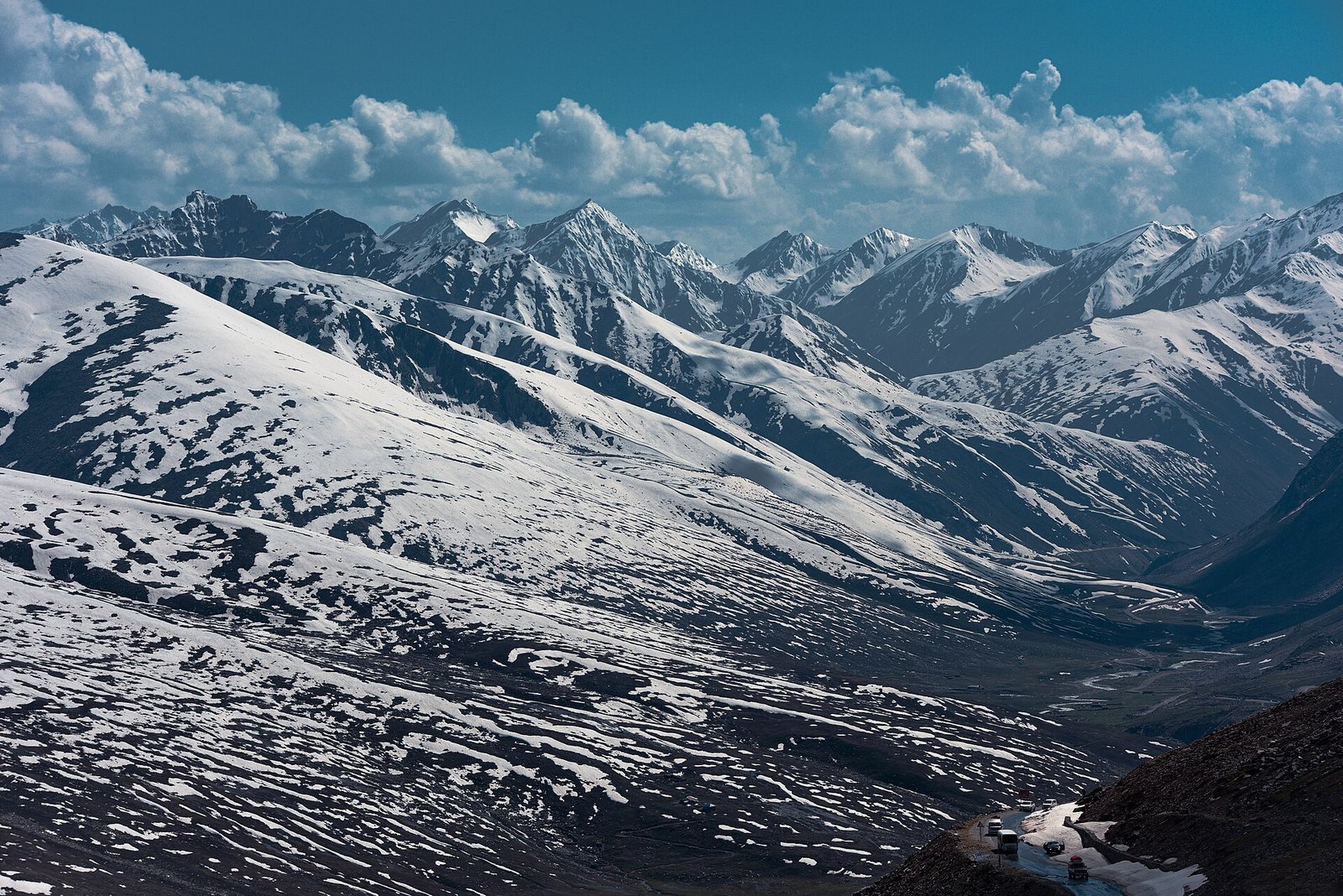
Babusar Pass: snowy peaks at Babusar Top
Destination guide

Babusar Pass: The Complete Travel Guide

Babusar Pass is the 4,173 m summer road between the Kaghan Valley and the Karakoram Highway, the highest point in Kaghan that ordinary vehicles can reach and a short cut north to Chilas, Fairy Meadows and Gilgit.

Updated October 2026By The Golden Adventure team
Photo: Lobozpics / Wikimedia Commons, CC BY-SA 4.0 (source)

Babusar Pass at a Glance

Babusar Pass carries the N-15 from Naran in Khyber Pakhtunkhwa over to Chilas in Gilgit-Baltistan. Open only in summer, it turns a 14-hour journey on the Karakoram Highway into about seven hours, and the ride itself, past lakes and high pastures, is one of the most scenic in Pakistan.

LocationBorder of Mansehra district (KP) and Diamer district (Gilgit-Baltistan)
Altitude4,173 m (about 13,700 ft)
Best time to visitJuly to September; the road is usually closed from November to late May or June
Getting thereAbout 75–80 km from Naran; about 40 km (around an hour) down to Chilas
Top sightsBabusar Top, Lulusar Lake, Batakundi, Gittidas meadows, the descent to the Indus
Known forThe scenic summer short cut from Islamabad to Gilgit-Baltistan

Where Is Babusar Pass?

Babusar Pass sits at the head of the Kaghan Valley, on the boundary between Mansehra district in Khyber Pakhtunkhwa and Diamer district in Gilgit-Baltistan. From Naran the N-15 climbs past Batakundi and Lulusar Lake to the top, then drops steeply through Babusar village to Chilas on the Indus and the Karakoram Highway (KKH).

Islamabad to the summit is roughly 350 km via the Hazara Motorway and the N-15, around seven hours’ driving without stops. The top itself, usually called Babusar Top, has a police checkpoint and only limited facilities, so bring your own food and water.

Why the Pass Matters

For travellers heading north, the route is a summer alternative to the long KKH journey through the Indus gorge via Besham and Dasu. Officials quoted by Dawn put the Diamer to Mansehra drive at about 7 hours over the pass, compared with about 14 hours on the KKH.

That advantage only lasts a few months. Each spring the National Highway Authority clears snow and avalanche debris: in 2025 crews cleared more than 21 glaciers between Naran and the top before the road reopened in late May, after about seven months’ closure. In 2026 the road was briefly opened one way for Eid, then shut again until 6 June so machinery could widen the carriageway and finish clearing.

MUST-SEE EXPERIENCES

Top 8 Things to Do in Babusar Pass

Most people drive straight over, but the pass and its approaches deserve a full day.

  1. 01
    Viewpoint

    Stand on Babusar Top

    At 4,173 m the summit gives sweeping views back down the Kaghan Valley and north towards Diamer. Bring a warm layer: even in August it can be cold and windy.

  2. 02
    Nature

    Stop at Lulusar Lake

    About 50 km from Naran at roughly 3,410 m, Lulusar is described as the largest natural lake in Hazara and a main source of the Kunhar River. Its still water reflects the bare peaks.

  3. 03
    Adventure

    Cycle the climb

    From the Chilas side it is a brutal climb of about 40 km with some 3,100 m of ascent and pitches up to 16%. The Naran side is a steadier, less punishing ascent.

  4. 04
    Nature

    Walk the Gittidas meadows

    Just below the top on the Diamer side, the open high ground around Gittidas (also spelled Gatidas) is a good place to stretch your legs and take in the views.

  5. 05
    Viewpoint

    Pause at Batakundi

    About 16 km above Naran, Batakundi is a natural first stop for tea and views of the upper Kunhar valley.

  6. 06
    Adventure

    Descend to the Indus

    The drop to Chilas, around an hour, takes you from alpine grass to the hot, rocky Indus gorge, one of the most dramatic changes of scenery on any Pakistani road.

  7. 07
    Nature

    Continue to Fairy Meadows

    From Chilas it is a short drive along the KKH to Raikot Bridge, starting point for the jeep ride and hike to Fairy Meadows below Nanga Parbat.

  8. 08
    Nature

    Visit Lake Saiful Muluk first

    If you base yourself in Naran, spend a morning at Saiful Muluk before crossing the pass.

Best Time to Cross Babusar Pass

Dawn reports that the road usually stays closed from November to June because of heavy snow. Recent reopenings have come in late May (2025) and early June (2026), but a late spring can push that back. July to September is the most dependable window, and even then snow can arrive early: the first snowfall of 2026 at the top was reported in early September.

The monsoon brings its own risks. In July 2025 a cloudburst on the Diamer side triggered flash floods that killed at least five tourists, swept away more than 15 vehicles and damaged about 8 km of road. Avoid crossing in heavy rain, and leave early enough to finish the descent in daylight.

How to Get to Babusar Pass

LegDistance / timeNotes
Islamabad → NaranAbout 6 hoursHazara Motorway, Mansehra, Balakot
Naran → Babusar TopAbout 75–80 kmVia Batakundi, Besal and Lulusar Lake
Babusar Top → ChilasAbout 40 km, around 1 hourSteep descent; brakes take a hammering
Chilas → Raikot BridgeAbout 1.5 hoursOn the KKH, for Fairy Meadows
Chilas → GilgitA few hoursOn the KKH

When the pass is closed, the alternative is the KKH via Besham and Dasu, which carries its own advisory issues (see below).

Driving the Pass Safely

Wikipedia calls it one of the most dangerous routes in Pakistan, with brake failure on the long descents the most common cause of accidents, often linked to inexperienced drivers. Use a well-maintained 4×4 or a sturdy vehicle with an experienced mountain driver, use low gears downhill, and never drive it at night. Expect police checkposts at the top, where passports may be recorded.

Where to Stay near the Pass

There is no real accommodation at the top. Most travellers sleep in Naran, which has many hotels, or in Chilas on the Gilgit-Baltistan side, where travel writers have noted that only a few hotels accept foreign guests. Camping is possible at Lulusar or in the Gittidas area with proper equipment.

Suggested Kaghan to Chilas Itineraries

Islamabad to Gilgit the scenic way (3 days)

Day 1 Islamabad to Naran. Day 2 Lake Saiful Muluk in the morning, afternoon to Lulusar. Day 3 over the pass to Chilas and on to Gilgit.

Naran to Fairy Meadows (4–5 days)

Cross to Chilas, continue to Raikot Bridge, then jeep and hike to Fairy Meadows for two nights. Our guide on how to get to Fairy Meadows explains each leg.

Cycling crossing

Ride from Naran to the top and descend to Chilas with vehicle support.

What to Pack for the Crossing

  • A warm jacket, hat and gloves for the summit.
  • Rain shell: weather changes fast.
  • Snacks and water, as facilities on the route are limited.
  • Motion-sickness tablets for the winding descent.
  • Passport and visa copies for checkposts.
  • Cash in rupees.

Culture & Etiquette

Diamer, on the northern side, is a conservative district. Dress modestly, do not photograph women, and be discreet with cameras in villages. At the busy summit, many Pakistani tourists will ask for photos; agree or decline politely.

Practical Travel Tips for Babusar Pass

Travel advisories

The southern approach is in Khyber Pakhtunkhwa, which the US State Department lists as Do Not Travel. The UK FCDO does not list the Babusar road, but advises against all travel on the KKH between Mansehra and Chilas via Besham and Dasu, the main alternative when the pass is shut. Read both before you go and check your insurance.

Road status

Opening dates are announced by the NHA and district administrations each year. Check the latest news the day before crossing, especially after rain.

Altitude

You only stay at the top briefly, but at over 4,000 m some people feel dizzy. Move slowly and drink water.

BABUSAR PASS TRAVEL

Babusar Pass Highlights at a Glance

This seasonal road is the fastest and most beautiful link between the Kaghan Valley and Gilgit-Baltistan, with lakes, meadows and a 4,000 m summit on the way.

Plan around the short summer window, respect the monsoon, and travel with a driver who knows the descent.

Background on the 2025 reopening is in this Dawn report.

Plan your Babusar Pass trip

Babusar Pass FAQs

How high is Babusar Pass?

Wikipedia gives 4,173 m (13,691 ft); Dawn quotes about 13,700 ft. It is the highest point in the Kaghan Valley reachable by ordinary vehicles.

When is the road open?

Usually from late May or June to around October or November. It reopened on about 23 May in 2025 and on 6 June in 2026 after snow clearance. July to September is the safest bet.

How long does it take from Naran to Chilas?

Naran to the top is about 75–80 km, and the descent to Chilas is about 40 km, roughly an hour. Allow most of a day with stops.

Is the Babusar road safe?

The main risks are road accidents, brake failure on the descent and flash floods in the monsoon; a 2025 cloudburst killed at least five tourists. The US State Department lists Khyber Pakhtunkhwa as Do Not Travel, and the UK FCDO advises against the KKH between Mansehra and Chilas. Check both and use an experienced driver.

Can I cycle over the pass?

Yes, it is a famous climb. The Chilas side is about 40 km with around 3,100 m of ascent and sections up to 16%, so it suits strong, experienced riders with vehicle support.

Is there anywhere to stay at the top?

No. Stay in Naran or Chilas, or camp with proper gear at Lulusar or Gittidas.

What is the alternative when it is closed?

The Karakoram Highway via Besham and Dasu, which takes much longer and is covered by a UK FCDO all-travel warning.

TGA AI AssistantOnline · usually replies in seconds
AI can make mistakes. Please don't share personal, passport or card details.